Photo: Jean Oscar Augustin
Nine of the Most Beautiful Destinations in Haiti
Sun-kissed and sandy-toed, we’ve toured Haiti to bring you our pick of the most beautiful places on the island. From Cap-Haïtien’s culture-rich streets to Port-a-Piment’s hidden caves, these are the Haitian destinations to escape to this season.
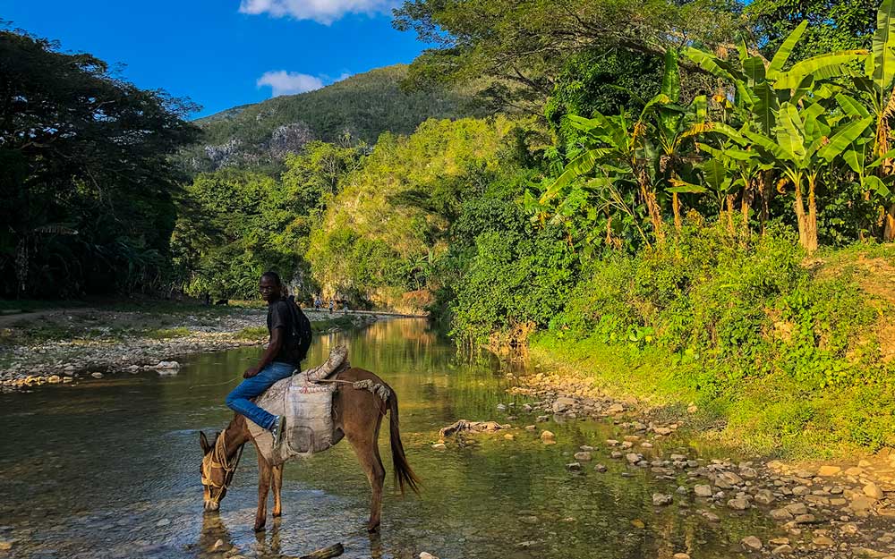
Haiti is brimming with destinations that are sure to captivate the hearts of travelers, vacationers, and nature lovers alike. This country, known for its mountains, is where raw beauty thrives and history comes alive. From the golden sandy beaches to the tropical rainforests, and not to forget the breathtaking waterfalls, here’s a roundup of the most beautiful spots in Haiti that you shouldn’t miss.
The Birds of Haiti on Your Wall
Elevate your space with our beautifully illustrated poster, showcasing 19 of Haiti’s most diverse bird species. Each one is captured in exquisite detail, bringing a piece of Haiti’s nature directly to your home.
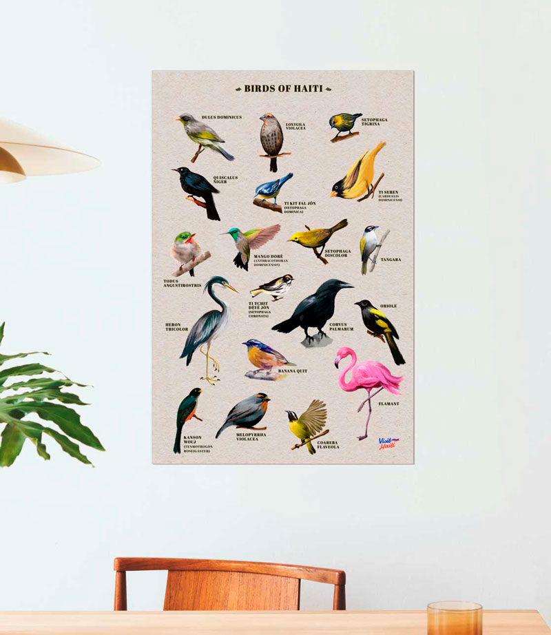

Photo: Haiti National Trust
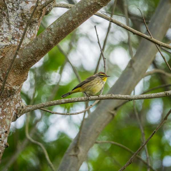
1. Macaya National Park
In the heart of an untouched rainforest lies Macaya National Park, a sanctuary where nature thrives away from human touch. The park is home to wildlife and plants that are unique to Haiti. Among these, you’ll find the Hispaniolan Solenodon and a variety of Hutia that calls the park home.
For birdwatchers and outdoor enthusiasts, this is a haven where you can spot the Narrow-Billed Tody (locally known as Chikorèt), the Hispaniolan Trogon (Haiti’s national bird), or one of the many other tropical birds that live here. The Macaya Peak, standing tall at 2,347 meters, is a hiker’s paradise, offering trails that are perfect for those looking for an adventure through the cloud forest.
Photo: Jean Oscar Augustin
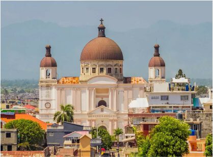
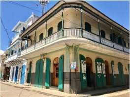
2. Cap-Haïtien
Cap-Haïtien, Haiti’s second-largest city, is swiftly emerging as the country’s prime tourist hotspot. This city is a tapestry woven with history and culture. As you wander through the streets lined with colonial houses, you can feel the city’s pulse.
But there’s more to Cap-Haïtien than just history; it’s a place where the past meets the present. With an array of hotels, and restaurants, there’s no shortage of places to relax and enjoy the local cuisine, and the nearby beaches are perfect for those who want to bask in the Caribbean sun.
For the adventure seekers, the city offers exciting excursions and fun activities, such as a day trip to Bassin Waka or an exploration of the mystical caves of Dondon. Cap-Haïtien is also home to the stunning Cathedral of Our Lady of the Assumption, with its iconic tiled dome.
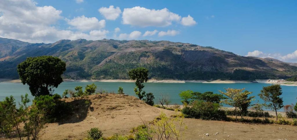
Photo: Franck Fontain
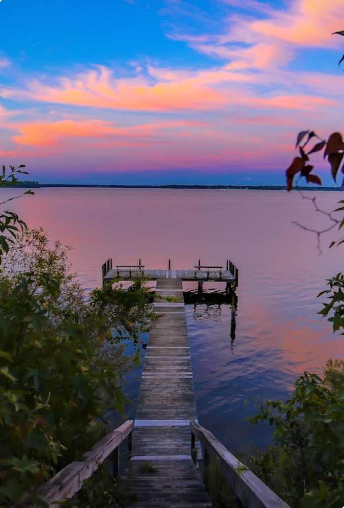
3. The Péligre Lake
Sometimes, nature and human ingenuity come together to create something truly beautiful, and the Péligre Dam is a testament to that. This hydroelectric dam has given birth to an artificial lake that is nothing short of a marvel. Cradled in the embrace of the mountains, the lake is akin to a vast emerald, with its lush greenery reflecting on the placid waters.
The dam, built on the Artibonite River, one of the largest rivers in the country, is a place where you can lose yourself in the sheer beauty of your surroundings.
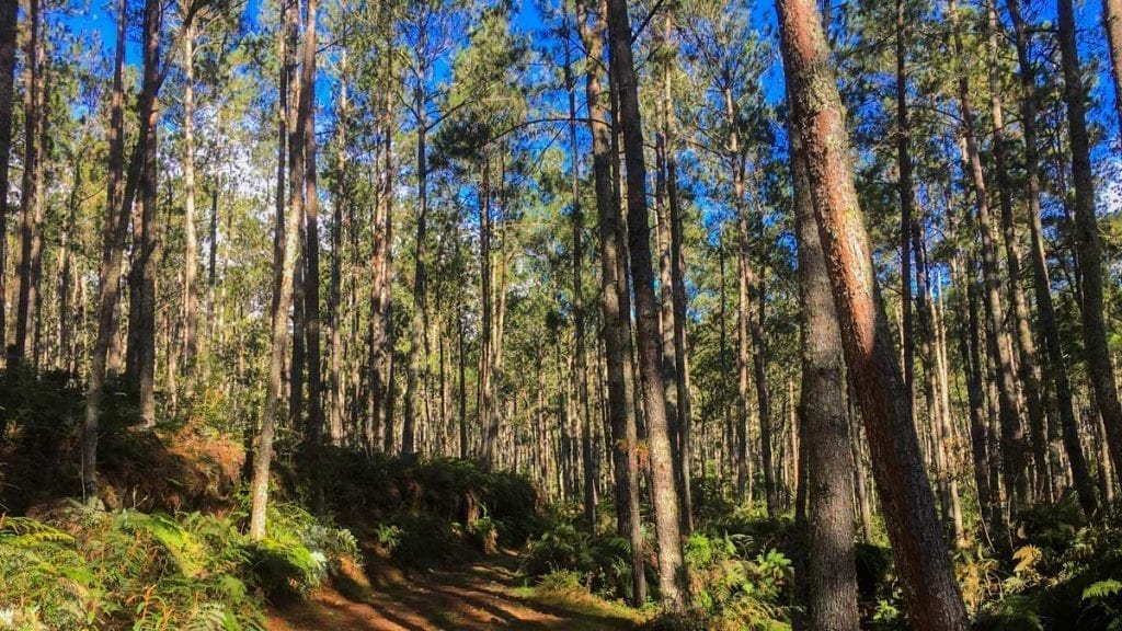
Photo: Anton Lau
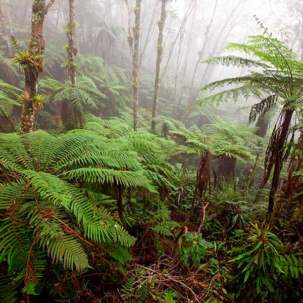
4. Forêt des Pins & La Selle National Park
Straddling the Haitian-Dominican border at over 2,000 meters above sea level, Forêt des Pins is a sanctuary of biodiversity and a dream for mountain hiking enthusiasts. Part of the La Selle National Park, this subtropical coniferous forest is home to the Pic La Selle, the highest mountain in Haiti.
What’s surprising is the climate; you might expect the Caribbean to be all about the heat, but up here in Forêt des Pins, the air is refreshingly cool. The forest is lush, with towering pine trees that seem to touch the sky. It’s a place where you can feel close to nature, with the scent of pine in the air and the sound of leaves rustling in the wind.
But Forêt des Pins is part of something even bigger. It’s a key piece in a chain of protected areas that spans across the Haitian-Dominican border, linking with other national parks on the Dominican side. This forms the La Selle Jaragua-Bahoruco-Enriquillo Biosphere Reserve which is one of only 21 transnational biosphere reserves on the planet.
Ready to take an epic journey across the island of Hispaniola through a biosphere reserve? Read all about it here!

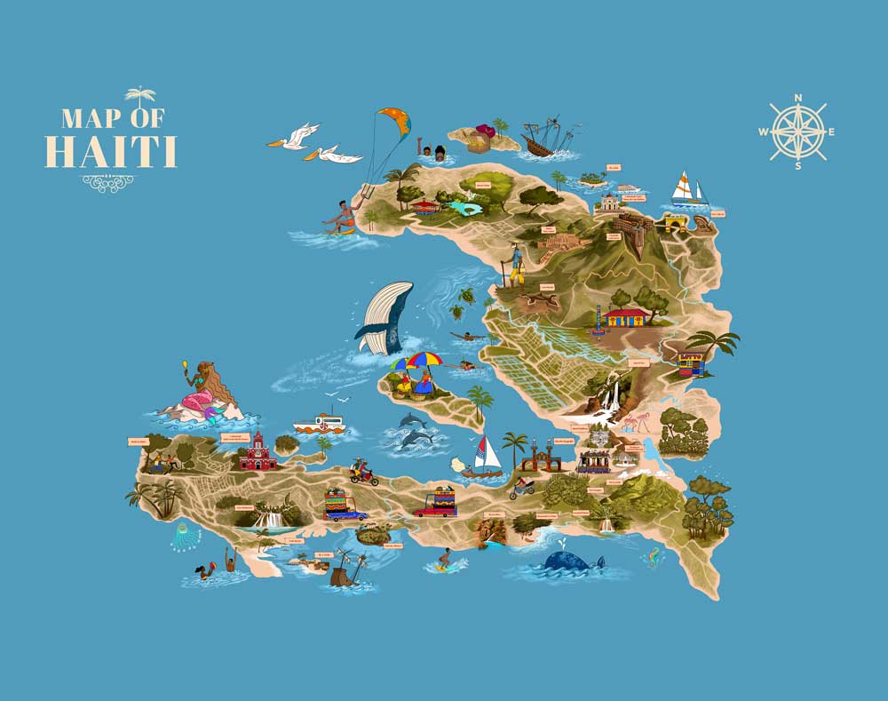
From Our Land to Your Home
Journey through Haiti’s beauty and history with our detailed island map. Discover landscapes, landmarks, and legends in one stunning poster perfect for your home.
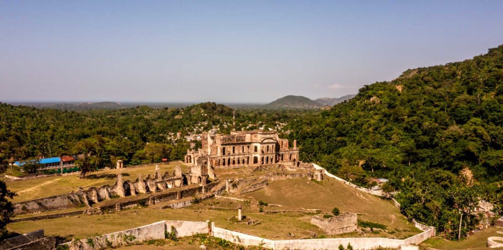
Photo: Jean Oscar Augustin
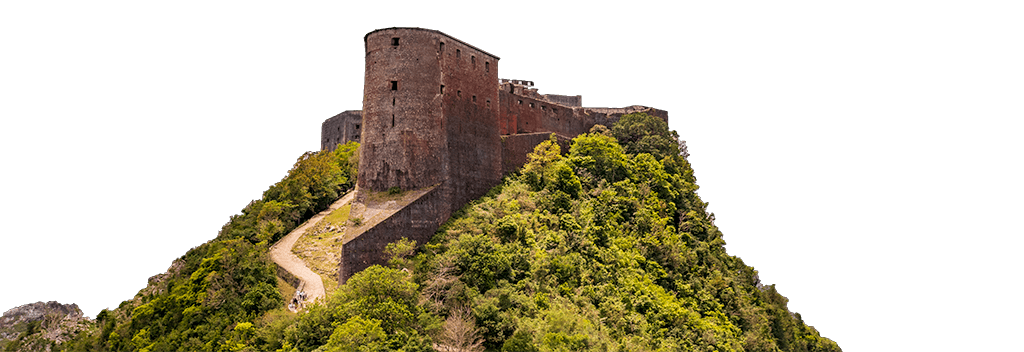
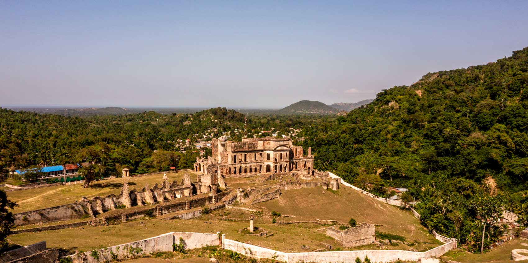
5. Sans Souci Palace
The Sans Souci Palace, built between 1810 and 1813, is a majestic embodiment of Haiti’s architectural heritage. This palace, with its baroque flair and inspiration drawn from Prussian architecture, is a reflection of the grandeur and ambition of the kingdom established by King Henri I in the wake of Haiti’s independence.
The palace is not just a building; it’s a symbol, an iconic representation of Haitian pride and history. As you walk through the ruins, you can almost hear the echoes of a bygone era, when the island was abuzz with newfound freedom and the nation’s greatness was at its zenith.
The Sans Souci Palace, along with the nearby Milot Chapel and the famous Citadelle, form a triumvirate of historical and architectural significance. These landmarks stand as a reminder of a time when the Haitian nation was carving out its identity on the world stage.
For anyone with a penchant for contemporary history and especially black history, a visit to the ruins of Sans Souci is an absolute must. It’s a journey through time, a glimpse into the soul of a nation that has fought for its place in history.
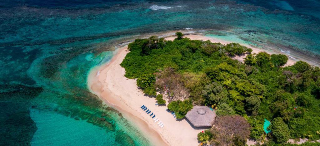
Photo: Jean Oscar Augustin
6. Île à Rat
Haiti boasts some of the Caribbeans most beautiful islands, and Île à Rat is no exception. This tiny, uninhabited island, with its golden sands, is a favorite among couples seeking a romantic getaway or anyone looking to unwind on a little slice of heaven. With a small, wild forest at its center, surrounded by a beach with the finest powdery sand, and a coral reef in crystal-clear waters, this island is pure bliss.
Just a short 15-minute boat ride from the coast, Île à Rat feels like a world away. The island invites you to indulge in activities like snorkeling and diving, exploring the vibrant underwater world. But if you’re looking for something more laid-back, how about just chilling in the shade of a palm tree with an ice-cold Prestige beer in hand?
One of the unique charms of Île à Rat is the occasional visit by local fishermen in canoes that often stop by to offer their freshly caught fish and seafood. And here’s the best part – they will gladly prepare it for you right on the beach. Imagine savoring the taste of freshly grilled seafood, with the sound of waves as your background music.
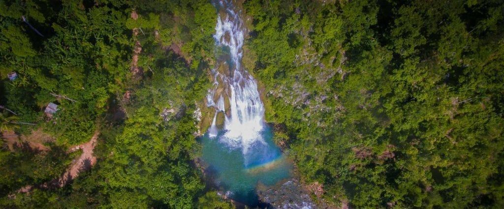
Photo: Ricardo Lartigue
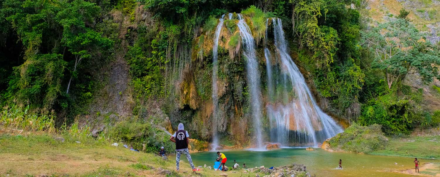
7. Saut Mathurine
Located between the cities of Les Cayes and Jérémie in Haiti’s South Department, Saut Mathurine is a captivating spectacle of nature. During the rainy season from April to October, the waterfall is at its peak, as the Cavaillon River’s powerful waters cascade into a 30-meter wide basin, enveloped by jungle-clad mountains. The waterfall’s roar and the mist that rises are a sight to behold. However, from November to March, during Haiti’s dry season, the waterfall takes on a calmer demeanor, transforming into a gentle stream.
Saut Mathurine is not just for sightseeing; it’s an invitation to dive into nature. Bring your swimming gear and take a dip in the natural basin. The water may be refreshingly cool at first, but as you adjust, the thrill of swimming near the waterfall is invigorating. For the adventurous, a swim across the basin followed by a climb up the waterfall for a daring leap into the water is an unforgettable experience. Be cautious, though, as the water gets deeper towards the middle of the basin.
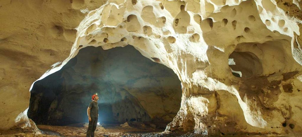
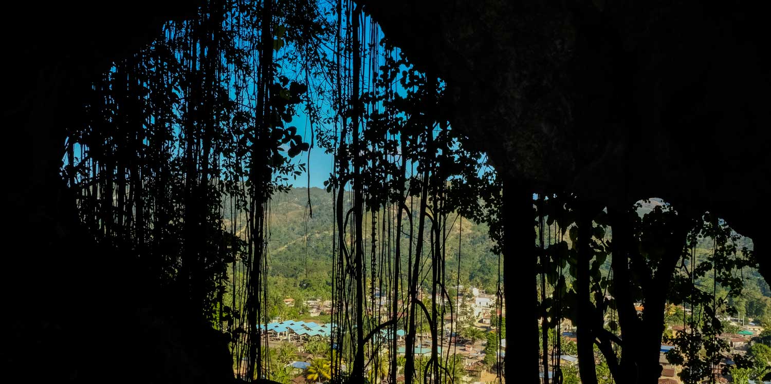
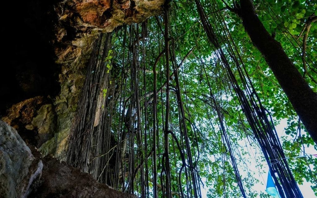
Photo: CavesOfHaiti.org
8. Grotte Marie Jeanne
Contrary to what you might expect, some of Haiti’s most beautiful destinations are hidden underground, and Grotte Marie Jeanne is a prime example. Located in the quaint city of Port-a-Piment, just a few miles up the coast from Port Salut (which is renowned for some of Haiti’s best beaches) this cave is an Eldorado of natural splendors. With over four kilometers of galleries and more than fifty chambers, Grotte Marie Jeanne holds the distinction of being the Caribbean’s most extensive natural excavation.
The daylight filtering through openings, coupled with stalactites hanging from the ceiling, creates an ethereal light that transports you to a magical realm.
And what adds to the allure of Grotte Marie Jeanne is its historical significance, as the cave is named after Marie-Jeanne Lamartiniére, a fearless woman who fought in the Haitian Revolution. She was one of the few women who took up arms and fought bravely for the revolutionary army.
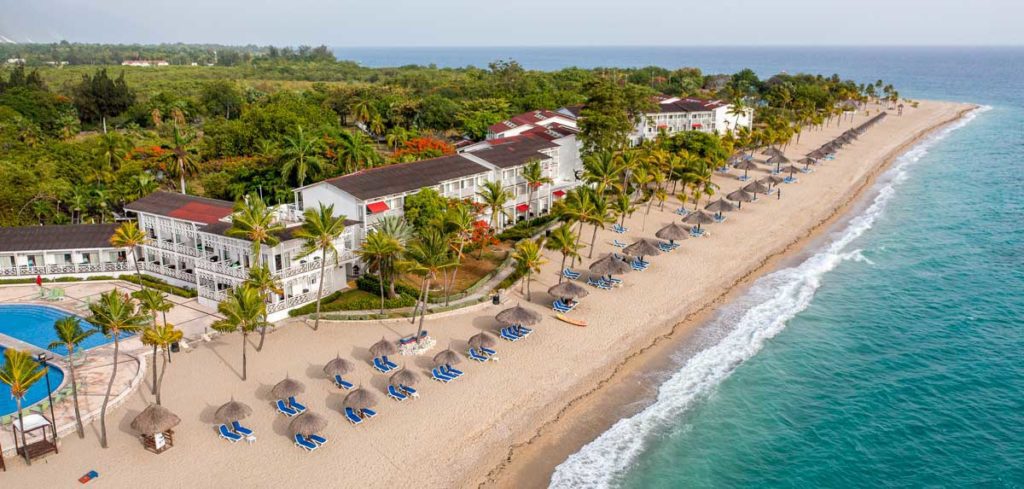
Photo: Jean Oscar Augustin
9. Cotes des Arcadins
Last up on our list of the most beautiful places in Haiti is Cotes des Arcadins, a tropical paradise boasting 19 kilometers of white sand along the northern bay of Port-au-Prince. Framed by coconut trees, a deep blue sea, and mountains, this destination is the go-to place for water enthusiasts. Whether jet skiing or diving to admire the stunning coral reef, Cotes des Arcadins offers an idyllic escape. The coast is also dotted with renowned resorts such as Club Indigo Decameron, Moulin Sur Mer, and Wahoo Bay.
Just a stone’s throw away is the buzzing city of Montrouis, which complements the serene beauty of Cotes des Arcadins with its lively atmosphere. Montrouis is a treasure trove of activities, from exploring local markets to indulging in Haitian cuisine. If you’re looking to escape the crowds, Amany Beach is one of Haiti’s lesser-known beaches, a perfect spot for a tranquil retreat and short 20 minutes drive from Cotes des Arcadins.
Written by Costaguinov Baptiste.
Published July 2023.
The Most Beautiful Places to Visit in Haiti
Sun-kissed and sandy-toed, we’ve toured Haiti to bring you our pick of the most beautiful places on the island.
Looking for some cool things to do?
Paradise for your inbox
Your monthly ticket to Haiti awaits! Get first-hand travel tips, the latest news, and inspiring stories delivered straight to your inbox—no spam, just paradise.